Gottakere lake situated in O-Mittur panchayat, Kolar district was mapped to understand its hydrological and social dynamics. The peak season for the lake is the months of October to November and the lake water is mostly used for agricultural purposes. The downstream lake is Yalagondahalli. The lake has three distribution channels or kaluves where one runs along the western boundary of the lake and the other two flow towards the west along two tree lines as that is the command area of the lake.

All three channels begin at the
outlet of the sluice gate.


The inlet of the sluice gate had
a stone marker near it to measure the depth of water in the lake.


The main inlet of the lake is
situated along its western boundary.

Another inlet for the lake is the Seetanamakere inlet from an
upstream lake. The stormwater drain from the Pichaguntlahalli village is let into the lake. There is a closed inlet
towards the northwest direction of the lake.
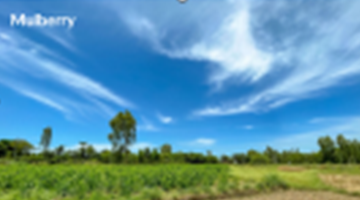
The lake has four open wells in its surroundings and four borewells in its command area. None of the wells is in use currently due to the presence of borewells and as the lake has water in it, two wells have solid waste dumpings in them. Well 2 was covered by trees and had a large snake in it. The water from the borewells is used to cultivate Mulberry and flat beans while the lake water was used to cultivate paddy. Agricultural practices in the command area took place in both Rabi and Kharif seasons.


There were 130 families in the
village out of which 80 had land holdings and were involved in farming while 50
households were involved in
non-agricultural activities with some being landless labourers. The village had
400 registered voters. Approximately 15 – 20 women are employed in agricultural
activities for a duration of 1.5 months in the harvest seasons.
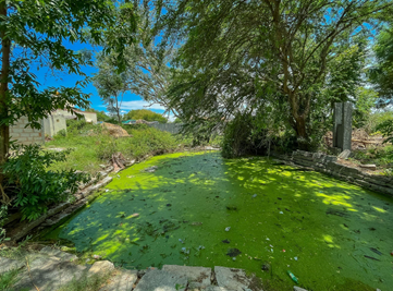
The waste weir is situated in the southwest
direction of the lake, it is currently broken and needs maintenance. There is a
small Kalyani in the lake in its southeast part for religious activities. The Kalyani
is completely covered by algal species with a clear presence of eutrophication.
There was
no presence of algal growth in the lake. The lake only had blooming pink water
lilies in it. Pongamia trees were commonly found around the lake and were used
as a part of biomass production. The banks of the lake were infested by Lantana
camara. Plantations of Eucalyptus were also observed in the command area of the
lake.


Refer to the presentation
for reference
Date of documentation:
13/06/22
By: Shivani Ilangovan,
Rohith Varma, Sadhana Joshi.
No comments:
Post a Comment